
I recently took on a project helping a client who had started work without a permit and was consequently sighted by the local jurisdiction. It turned out that the scope of work he was performing did not require a full set of drawings, just a site plan.
Easy-peasy, I thought.
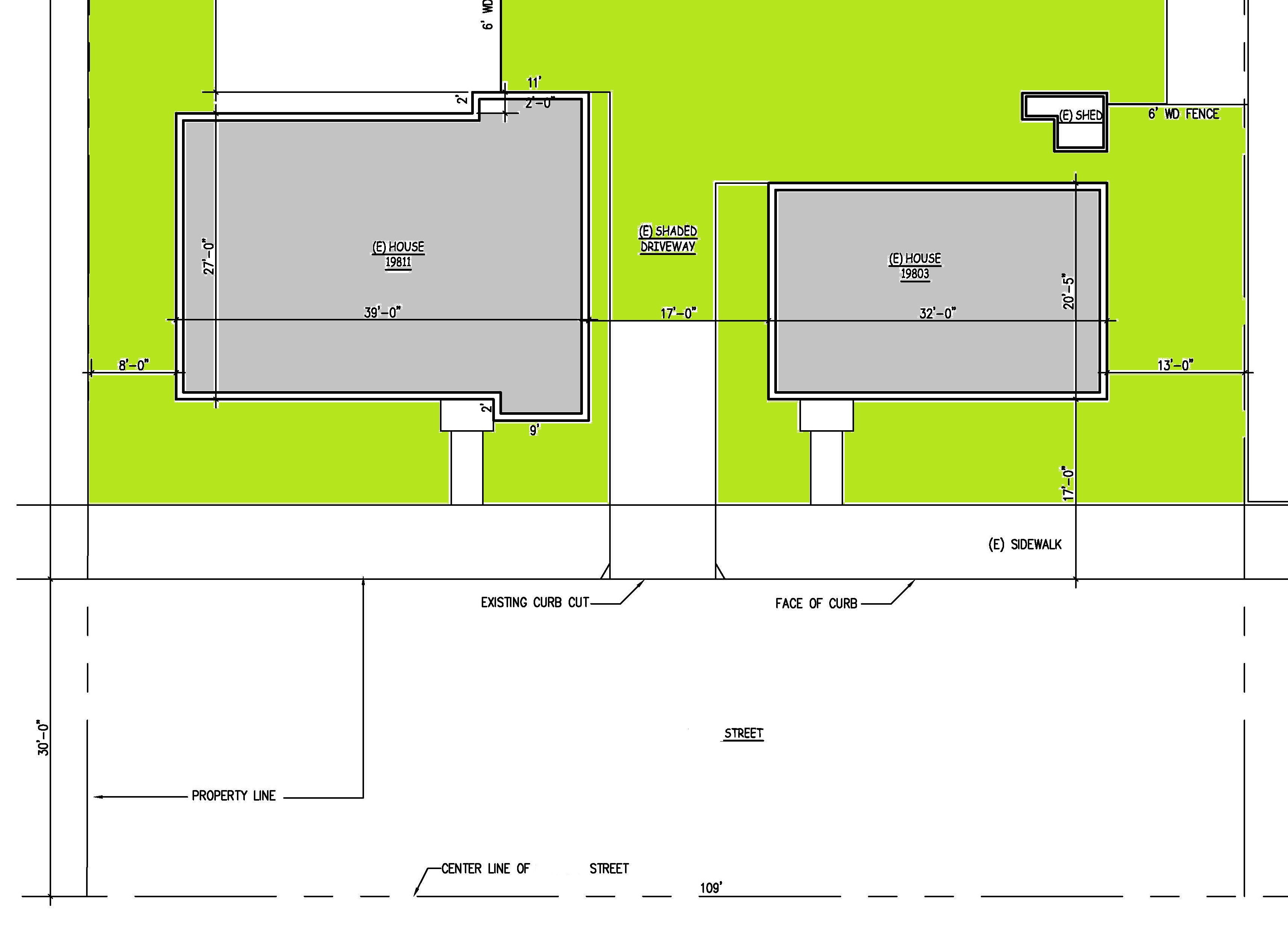
He sent me some information he had. I looked up the site information that the local assessor had. I went out to the site and field measured the site, buildings, and major trees.
Then I went back to my office and started to sketch up the site plan for my drafter. But what I found was for the depth of the lot, from the street to the back property line, none of the official documents coincided with the dimensions I measured on the site.
The assessor’s parcel map said the lot was 180 feet deep. But it only measured 150 feet. The assessor’s parcel map showed that the front property line was at the face of the curb.
It is not uncommon for suburban lots to vary by 1 or 2 feet from the assessor’s parcel information, as people build and tear down fences. But I’d never had a 30 foot discrepancy.
I went to the local jurisdiction and dug into the files for the property. That turned up very little information: but it did provide a partial site plan from 1951 which showed the distance from the front of the lot to the back as 108′. Now I had three different dimensions!
It took some digging around and talking to one of the gray haired planners who’d been there a long time. What he told me was that contrary to what the assessor’s parcel map showed, the property line was at the center line of the street. The street is 60′ wide. The front 30′ of the lot is a public works easement, which is not shown, for reasons unknown, on any of the surveys.
That solved the mystery! The property is 180′ deep, but the public works easement, extends from the front property line to the curb. With that mystery solved, we could wrap up the site plan.


